The Qhapaq Ñan, is the word that defines the road system of the Inca Civilization and is definitely the best material test, which can give us an idea of the magnitude of this empire, becoming one of the greatest achievements in indigenous America. An estimated 23 thousand km is calculated, although other studies say that up to 40 thousand km could be registered, from an extensive network of roads, built on one of the most rugged territories in the world, which communicates the cities and settlements of the state most important in America, before the Spanish invasion.
This network of roads crossed the Empire of the Incas, along roads drawn from north to south (from end to end) along the coast, mountains and jungle; through the Cordillera de los Andes, with small sections, which communicated from the east of its territory to the Pacific coast. Designed in harmony with the topography of the place, wide in some areas, very narrow in others, with completely cobbled sections and others simply of land.
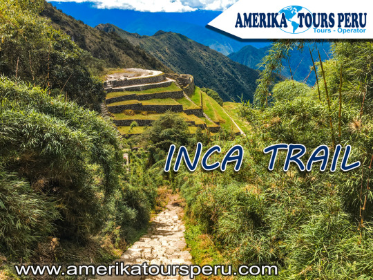
Like all the important cities of the Empire, the city of Machu Picchu, connected to Cusco (capital of the Empire), through the Inca Trail that we have traveled so far, at least two important accesses to the Sacred City (Inca Trail and Camino Salkantay), although there may be two others; one that descended through the Urubamba valley from Ollantaytambo, and another that crossed the high part of the Andes. And together with these, a complex network of secondary roads, to communicate the existing settlements throughout the region.
The world-famous Inca Trail to Machu Picchu, is only part of this complex network of roads, which goes up the Urubamba River basin to the Inca City, named for being the most suitable name. At present it is considered by many, the most beautiful of all, for the complement present between its landscapes and its history, you can visit it in three or four days, on a perfectly planned tour.
This Inca Trail to Machu Picchu, allowed to join production sites, with storage and administration centers. It is located in the middle of the jungle, which provides adequate environmental conditions for the production of specific foods. It is very likely that the entire Empire was supplied from this area. Therefore, this road articulated Machu Picchu with the capital and this with the other cities.
The gigantic network of roads of the Inca empire (Qhapaq Ñan) was built with the main purpose, to keep a huge territory communicated, this allowed to mobilize armies very quickly for the time. But it had other very important uses, as it served as trade routes, acting as an economic articulator, in a civilization with a tendency to redistribution and exchange, in the same way that Machu Picchu's corn or coca reached Huánuco, In Huánuco, surplus production (potatoes and others) was redistributed in other locations, such as Machu Picchu. Another extremely important purpose was the representation of the central power of the empire, as it was thought ideologically; -Yes, I know Cusco because I have seen the road- Then, the road was the essential ideological representation of the power of the Empire, both economic and ideological.
This path, a means of communication and transport par excellence, fundamental in economic articulation and ideological dissemination, was essential for the existence of such a vast territory. It crossed the central squares of the main towns of the Empire, joining places of worship, commerce and administration, passing through water sources, an element (fundamental for life) that symbolized the goodness of Mother Earth and the reproduction of life.
And despite the information available, the Inca Trail is only a small branch of the Empire's road network, an important tourist attraction in Peru and one of the largest in the world. Although the fact in itself, of knowing new places, what we offer is fantastic, goes beyond a visit to the Machu Picchu Sanctuary in Peru; We offer an approach to the culture of the people who built those places, to the people who currently inhabit those places, their customs and their history. So you can transform visible material evidence into an experiential learning experience.
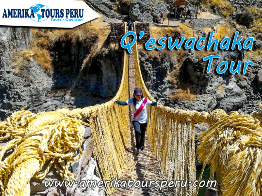
During the time of the Incas there was a great network of roads called “Camino Real” to unite the Inca empire. However, due to its rugged geography many places were joined by suspension bridges made of vegetable fiber.
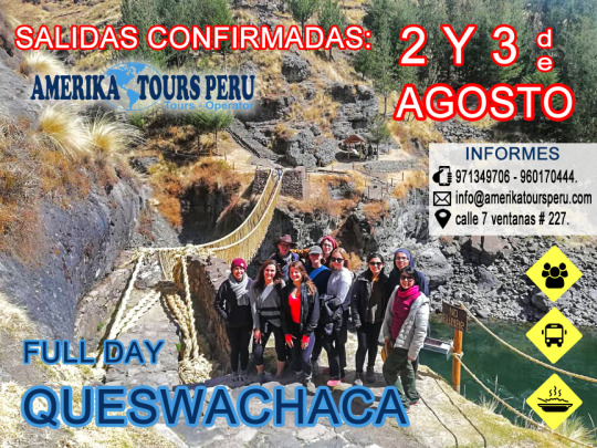
The Qeshuachaca is the only bridge that has been renovated from generation to generation by the families of Cusco until today. The bridge is located in the department of Cusco, over the Apurimac River at 3,700 m.a.s.l. About a thousand people from different communities, near the bridge, meet for four days to renew it.
Now, we will know the four days of tradition that delays the reconstruction of Queshuachaca: On the first day, the inhabitants of the communities leave in search of a solid straw of vegetable fiber called Ichu in Quechua. Once the necessary amount of Ichu has been collected, the women weave this solid straw to form the ropes of the bridge, and the men are in charge of joining the rope from end to end and then braid it.
When the second day arrives, the structure of the old bridge is taken apart, the stone nails that support the bridge are removed, and four ropes are placed, which are the base of the structure of the new bridge. Tired, but with strength, on the third day, the villagers conclude with the assembly of the handrails and the bridge surfaces where the communities will cross.
Queshuachaca Tour And finally, on the fourth day, they celebrate the reconstruction of the bridge to the sound of music with native dances, since the work is considered as a holiday by Peruvian ancestors.
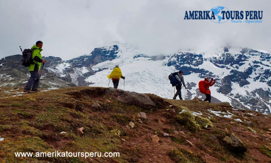
Ausangate is the fifth highest mountain in Peru, with its 6384 meters high, located in the Pitumarca district, Canchis province, Cusco region, in southern Peru; Ausangate is considered the most important mountain in the Andean worldview.
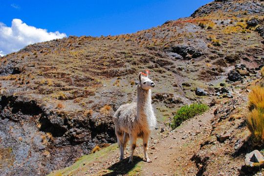
The “Apu” Ausangate is for the Andean culture, life giver and guardian of one of the most varied ecosystems in the world; Its name means "copper" in Quechua. When you are on this mountain, remember that it is sacred to local people; In fact, many of the nearby Andean communities still have pilgrimage dates to the top of the mountain. As the community of Chillca; of shepherds of llamas and alpacas, which have inherited Inca and pre-Inca cultural traditions. It is possible to share the daily life of the shepherds and work with the llamas. RAINBOW MOUNTAIN TREK
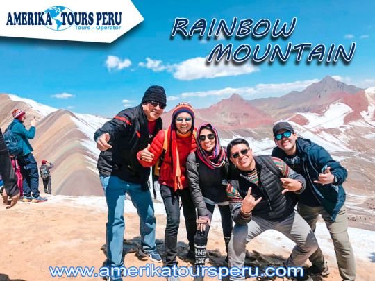
Climate change has discovered the multicolored beauty of these mountains located in the Vilcanota, Vinicunca or Winicunca mountain range, also called Seven Color Mountain, Rainbow Mountain or Mountain of Colors (the inhabitants call it Cerro Colorado) is a mountain of Peru with a altitude of 5,200 meters above sea level and owes its incredible coloration to the richness of minerals that houses its soil, the Winikunka mountains are behind the imposing snowy Ausangate.
A walk through these parts constitutes a very special experience, combining the fact of being at such levels with the enjoyment of an outdoor activity and the contemplation of a visual wonder.
Leaving the city of Cusco, you drive along the Longitudinal race of the Peruvian Sierra del Sur in the direction of the town of Checacupe where you take the fork towards the town of Pitumarca, and from this town you travel the journey through a carrosable trail passing through several rural communities such as Ocefina, Japura, Hanchipacha, until arriving at the community of Pampa Chiri, where the road ends and the 5km walk begins approximately until the Vinincunca pass. where you can see the Natural Formation in the shape of a Rainbow, considered the Mountain of Colors.
Our Ausangate
trek
5 Days is an amazing and less-known trek surrounding the snow-capped Sacred Mountain Apu in Quechua of Ausangate (6.372m/20900ft) that takes you over mountain passes, awesome mountain scenery, remote Andean villages, hot springs, turquoise lakes and the new natural wonder the rainbow mountain.
- PRIVATE SERVICE:
• $480 p/p (Min. 2 pax)
• $460 p/p (Min. 3 pax)
• $440 p/p (Min. 4 pax)
• $420 p/p (Min. 5 pax)
- SHARED SERVICE (RETURN ONLY):
• $470 p/p (Min. 2 pax)
• $450 p/p (Min. 3 pax)
• $440 p/p (Min. 4 pax)
• $430 p/p (Min. 5 pax)
DAY 1: CUSCO- QUESIUNO- JAMPA Pick-up times in Lodgings: • Private Transportation: 06:00 A.M. • Shared Transportation: 03:00 A.M - 4:00 A.M. Our pickups start from 06:00 a.m. (private transport) or 03:00 to 04:00 (shared), depending on the service contracted from their respective lodgings, to direct us to Urcos, bordering the Vilcanota river to reach our destination that will be the community of Quesiuno (3 hours by car) where we will receive our breakfast in the camp, after that we will travel about 20 min. more by car to start our journey through a part of the Andes, observing the wonderful Apu Ausangate on your side, after a 3 hour walk, we will go to our base camp, located in the hampa community, where they will receive your dinner and small information for the next day.
DAY 2: CCAMPA- 7 LAGOONS- PACCHANTA
In the morning (06:00 am) we will start preparing for our breakfast at 07:00 am, after that we will start our hike to the 7 lagoons of Ausangate (4 hours approx.), Where you can observe the existing biodiversity in the place and in addition to those appreciate these beautiful turquoise lagoons, we will do one for about 1 to 2 hours to receive lunch and then we start our trekking to the town of "PACCHANTA" (2 hrs.). The community of "PACCHANTA" is located on the slopes of the snowy "Ausangate", at 4200 masl. Its inhabitants, who are dedicated to the raising of alpacas and the cultivation of native tubers, are all expert weavers. With the fiber of the alpaca they make their clothing and use their meat as a source of protein. Native potatoes, fresh or traditionally converted into chuño and moraya, provide the carbohydrates they need to fight against cold and physical exertion. Here is where we will set up our camp and then you can enjoy some refreshing and replenishing thermal baths located in the same community. Dinner, rest and small information for the next day.
DAY 3: PACCHANTA - UPIS - YANACOCHA LAGOON
In the morning (06:00 a.m.) we will begin to prepare for our breakfast at 07:00 a.m., to begin our journey in the middle of mountains and colors towards the town of Upis (2 hrs and a half), where we will receive our lunch. During the journey we can see different types of turquoise lagoons in the middle of these wonderful mountains, such as: "Azul cocha, Puccacocha and Ccomercocha", after 3 hours walking and enjoying the scenery, we will arrive at a beautiful lagoon called Yanacocha, in which our camp will be located. Dinner, rest and small information for the next day.
DAY 4: YANACOCHA LAGOON - ANANTA
Our fourth day will start early (06:00 a.m.), to prepare for our nutritious breakfast at 07:00 a.m., and start saying goodbye to this wonderful lagoon. We will walk approximately 5 hours to reach the town of Ananta, where you will have the afternoon free to share and explore the surroundings of this beautiful landscape, since our camp will be in this same place. Dinner, rest and small information for the next day.
DAY 5: ANANTA - RAINBOW MOUNTAIN - CUSCO
Very early in the morning (05:00 AM) we will get up and prepare for our nutritious breakfast (06:00 AM) and begin our adventure towards the wonderful "RAINBOW MOUNTAIN", step of 5,029 meters above sea level, where you can see beautiful landscapes , lagoons where South American camelids (alpacas, llamas and vicuñas) and other species of mammals such as pumas, Andean birds, condor etc. live. The place called Montaña VININCUNCA, is where you can see the wonderful colorado hill with the sunrise shows its best impressive valley and colored hills of magical colors that only exists in this place in Peru. Around you can see mountains like Apu Sarinini and "Montaña Ausangate", with a height of 6,372 m.s.n.m. being one of the highest in Cusco. In the Inca mythology of this mountain and the nearby lakes - among which Sivinacocha stands out, from where the masculine energy that fertilizes the sacred earth mother Pachamama is born. We will be visiting the Mountain of Colors approximately 30 minutes, in which our guide will give us a small explanation of their surroundings and take some pictures of this wonderful landscape. After this wonderful experience, we will begin our descent (2 hrs and 30 min approximately) to the town of quesiuno, observing the wonderful landscape it offers us and the small towns that are there and live in this wonderful valley, upon arrival we will receive our exquisite lunch buffet, which consists of typical Peruvian food, then pack and return to Cusco around 19:00 hrs. approximately.
The Sacred Valley for the Incas With the river feeding the valley, its fertile lands were one of the main centers of food production during the time of the Incas; Some places, such as Moray, were used as agricultural laboratories, to experiment with species of plants brought from across the empire. The Incas cultivated potatoes, white corn, coca, fruits and vegetables, on terraces like those that can be seen in many valley villages specially designed for this purpose. Today the valley produces lucuma, peach, avocado, and one of the best corn grains in the world.
But it was more than just an important agricultural center; The Urubamba River Valley, "Willcamayu" for the Incas, was one of the most important elements in the religious cosmology of the Incas. They believed that the flow of the Urubamba was closely linked to constellations and mountains, they also believed that it was the counterpart of the milky way on earth.
information: Machu Picchu Tour
Where is the Sacred Valley of the Incas? The Urubamba river valley or "Sacred Valley of the Incas", is located 15 km northeast of the city of Cusco, is reached by a paved road. A trip by car to one of the nearest villages will take around 40 minutes. From there you can move to the other villages in the valley. What is the weather like in the valley? The Sacred Valley of the Incas is 2,800 m.s.n.m., 600 meters below Cusco, and enjoys one of the best climates in this region, daytime temperatures vary between 19 ° and 24 ° C. This privileged climate made the Incas take it as their main center of agricultural production, experimentation and research. Nowadays, travelers use the valley to acclimatize themselves, before starting their tours through Cusco and Machu Picchu, and without a doubt one of the best ways to avoid altitude sickness. What to see in the Sacred Valley of the Incas? Known by the Incas as Willcamayu, the beautiful valley extends from the town of Pisac to Ollantaytambo, along the Urubamba river. The ancient Inca settlements in these cities are presented as checkpoints, before entering the "Inca Trail" that leads to the sacred city of the Incas, Machu Picchu; They are simply amazing, and one of the best before what you will see in wonder. Pisac The town of Pisac is located 33 kilometers from the city of Cusco and is presented as the door to the Sacred Valley. It is world famous for its craft market and its impressive archaeological remains, located on a mountain above the town. This town was a kind of capital of the region in the time of the Incas, very important for its excellent location and its fertile lands. The Inca and colonial constructions that are exhibited in its territory, are admirable for its great bill and for the platforms that surround the mountains and polished stone structures, assembled to perfection. On the other hand, the people of Pisac has become the spiritual center of the Sacred Valley, in it you can have all kinds of experiences and spiritual retreats, in addition to meeting people from all over the world interested in this. Urubamba Urubamba is one of the most important cities in the valley today, it is a city that was born during the colony and is considered the world capital of corn. This is possible because it is watered by numerous rivers that are born in the peaks of the glacial mountains; This whole territory was highly appreciated by the Incas due to the fertility of their lands and the great qualities for cultivation. It is one of the best places to relax in the valley, you will see many foreigners, but beware, they are not tourists, they are people who left their countries and decided to stay in this cozy town. Ollantaytambo Ollantaytambo, also known as Ollanta, is located 97 km northwest of the city of Cusco; approximately 2 hours and 30 minutes by car. It was during the time of the Incas a fortified city, with temples, urban, agricultural and defense walls. It is known that the Inca city of Ollantaytambo served as an administrative checkpoint. After the Spanish invasion, it became one of the favorite places of the viceroys. It is considered one of the most important archaeological sites in Peru and South America; In addition, many people consider that after Machu Picchu, the town and the ruins of Ollantaytambo contain the most impressive Inca stone work in Peru; However, it is not the only amazing thing about this place. Only a few years ago, global positioning systems allowed us to discover that Ollantaytambo is aligned with other ancient constructions throughout the world; the pyramids of Gíza, the Easter islands, the Nazca lines, are just some of them; In addition, the most important archaeological remains around the world are aligned around this line. We recommend you visit the Inca city of Ollantaytambo, otherwise, you will be missing out on something very big. Chinchero On a normal tour of the Sacred Valley of the Incas, the town of Chinchero will be the one you will visit after touring most of the valley, back to Cusco; It is located 28 km from the city of Cusco at 3,772 m.a.s.l. and it has important archaeological sites, a beautiful 17th-century colonial church with canvases of the "Cuzqueña School", and a typical market where bartering can still take place.
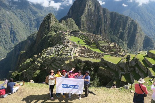
The llaqta (city) of Machupicchu is an Inka political, religious and administrative center, which includes temples, platforms, houses and water channels.
Where it is located? The llaqta of Machupicchu is located in the district of Machupicchu, province of Urubamba, of the Cusco region, at the height of km. 112.5 of the railway line and it was a graben between the mountains of Machupicchu and Waynapicchu.
History and architecture Built during the first half of the fifteenth century, Machupicchu is divided into two large areas: the agricultural one that comprises a vast network of artificial terraces or terraces, and the urban one formed by various constructions and squares among which the temples of the Sun, of the Three Windows, of the condor and the main temple.
Important data: - The Historic Sanctuary - Machupicchu National Archaeological Park was included in the UNESCO World Heritage List as a mixed cultural and natural heritage, due to its exceptional universal value, considered as an important political, religious and administrative center of the Inca era.
- Its temperature ranges between 6.2 ° C 29.5 ° C, since it is located in a subtropical zone. Its rainiest months are from November to March.
- Its majestic architecture comprises about 140 structures throughout the Inka llaqta.
- The average altitude of the llaqta is 2 450 m.a.s.l.
- His scientific discovery is attributed to the researcher Hiram Bingham, who was in search of the last capital of the Incas of Vilcabamba.
- Machupicchu was declared "Historic Sanctuary of Peru" in 1981. General data
Machupicchu means old mountain, named for the location of the llaqta inka.
The architectural complex was built in the mid-fifteenth century and according to historians it would have been built at the request of the Pachakuteq inka.
The exact location is in the Machupicchu Pueblo district, province of Urubamba, 112.5 km northeast of the city of Cusco.
Machupicchu was interconnected with the entire Inka empire through the Qhapaq Ñan, known as the Inka Road Network.
Its annual temperature is 6.2º C minimum and maximum of 29.5º C.
The llaqta of Machupicchu has two defined zones: agricultural zone formed by the platforms and terraces, and the urban zone that fulfilled administrative functions.
The average altitude of the llaqta is 2,450 meters above sea level.
The mountains of Waynapicchu and Machupicchu are ideal for panoramic photographs of the entire archaeological complex.
Entrance Tickets Due to the growing flow of tourists who wish to visit the Machu Picchu Inka Llaqta and to ensure that their experience is memorable, it is recommended to organize the visit well in advance, for which the following should be taken into account:
• Buy tickets to enter Machupicchu in advance, for limited daily capacity, check availability at www.machupicchu.gob.pe (only official page). • In case you cannot make your purchase through the website you can make it in person at the ticket offices of the Deconcentrated Directorate of Culture Cusco - DDC, located at Calle Maruri N ° 340 (Palacio Kusicancha) and Calle Garcilaso s / n (side of the Regional Historical Museum) from Monday to Saturday between 07:00 - 19:30 hours (does not attend holidays). The sale of admission tickets is subject to availability. • The Decentralized Directorate of Culture in Machupicchu Pueblo is the last point of sale, so a last minute purchase will mean subject to the availability of remaining spaces in the system, also the payment is only in soles and cash. Credit cards, debit cards or payment in dollars are not accepted. • The purchase of a student ticket is in person or through a travel agency prior to the presentation or remission of a valid student card. ISIC card is not accepted. • Entry to SHM - PANM is from the time indicated on the ticket, so early admission is not allowed. • Bring printed the entrance ticket to Machupicchu. • Before entering the llaka inka make use of the hygienic services, since the visit will last an average of 2 to 4 hours (There are no hygienic services within the llaqta). • Re-entry is only allowed for visitors who have a visit to the mountains of Machupicchu and Waynapicchu, and entrance tickets for the mountains can be purchased in advance through the website www.machupicchu.gob.pe, they are also subject to availability, taking into account that the maximum allowed entry capacity is 400 visitors per day for each mountain, divided into two groups of 200 visitors per shift.
The Suspension Bridge in Cusco declared universal heritage, also known as the bridge of the Inca Queswachaca; It is one of the most impressive legacies that can be seen these days, know this suspension bridge in Cusco, where the inhabitants still maintain and renew every year.
Empire of the Incas, fulfilled a very important function of unique cocexion with the other end even until the arrival of the Spaniards where the Queswachaca Bridge had resistance to pass a whole group of Spanish battalions.
More Information: Queswachaka tour
Hanging Bridge Cusco or Q'ueswachaka It comes from the Quechua word means Q'ueswa = Braid, Chaka = Bridge, the bridge is located above the Apurimac river, which is 15 meters high, the Q'ueswachaka bridge belonged to the network vial del (Q'apac Ñan), which is located on the route of the South Valley.
Our staff will be happy to help you complete your visit to this beautiful place, on our tour, we will also visit the 4 lagoons of Pomacanchi, Acopia, Asnapcocha, Pampamarca, our guide will make a detailed explanation of the importance of these places.
Therefore, if you are in Cusco do not hesitate to visit, the Q’ueswachaka Bridge 2019, it will be a great experience of all your trips.
AMERIKA Restaurante Turístico, es un acogedor restaurant estratégicamente ubicado en la ruta de Cusco - Sicuani, el restaurante tiene una vista excelente de parte del valle sur. Todos nuestros deliciosos y contundentes platos son una deleite de sabores e ideales para el clima cusqueño. Los precios de los platos son los más razonables, y naturalmente preparados.
Forced by circumstances - competition, mass tourism - Cusco operators point to the south, whose quality destinations are only visible. However, years ago, visionary agencies such as Pukupuku Travel (Facebook Pukupuku Travel) explored that territory and positioned new routes long before the Sacred Valley overcame. http://bit.ly/amerikatoursperu
Needless to say, we did not enjoy the cosmopolitan Cusco night, because at 4 in the morning he picked us up from the Ricardo Reátegui Hotel (T. 959136848), one of the top guides in the region. It was cold in Huayqui, the starting point, but as soon as we started beating for a majestic puna we went into heat. We do not cross any tourist, only shepherds taking care of their flocks, and this route is more for travelers in search of spirituality drowned in commercial tours.
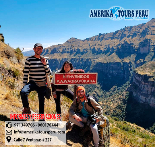
Suddenly, an amazing hollow interrupts the altiplanic plain. With astonishment, the archaeologist Miguel Cornejo tells him, who investigated the place in 2010: “Before entering Waqrapukara, you reach a space formed by river and wind erosion. The whole natural environment warns that a special place, out of the ordinary, of incomparable beauty is being reached ”.
The abyss that forms the Apurimac River is the cherry of the cake and makes Waqrapukara (4,104 m.a.s.l.) one of the most spectacular landscapes in the Andes. Inca architects molded their buildings to geography. "It is a first-class Inca sanctuary, which denotes immense political and religious power not yet deciphered," adds Cornejo.
“AMERIKA TOURS PERU” welcomes you. We have for you private and group tours. Our main goal is to always provide quality service, so customer satisfaction is our best reward.
AMERIKA TOURS PERU, offers you various treks, hikes, tours and holidays in Cusco which include the Classic Inca Trail as well as several alternative treks. For details see Inca Trail to Machu Picchu and Alternative Inca Treks around Cusco. Also available other tours in different parts of Cusco, how Choquequirao y Ausangate. MISSION Be the first tour company local, national and internationally recognized for excellence in the provision of tourist services and in meeting the needs of our customers and prospects. VISION Provide excellent travel service with reliability, responsibility, punctuality and safety.
We will pick you up from your Cusco hotel at 5.00 am in our transport, and then drive for 2 hours to Curahuasi (2909 m. / 9543 ft.), village where we will have breakfast, and then we continue to Capuliyoc, we arrive to nice view point called Capuliyoc (2915 m. / 9561 ft.), from here, we will have the privilege to see spectacular views of Padriyoc and Wayna Cachora snowcapped peaks (mountains over 5400 m.). At this point we will have some time to enjoy our snacks and we take some pictures of the breathtaking views of the river and the canyon stretching down the valley. From here we will descend through a unique zigzag path for 2 hours more to reach our place for lunch. Finally around 1 pm. we will have lunch. You have time to relax, put your feet up and have some refreshing tea, before we get ready to hike again for 2 hours more descending, so, we will reach our campsite located at Chiquisca (1836 m. / 6023 ft.) around 5 pm. where we will spend the night.
DAY 2: CHIQUISCA – MARAMPATA – CHOQUEQUIRAO RUINS
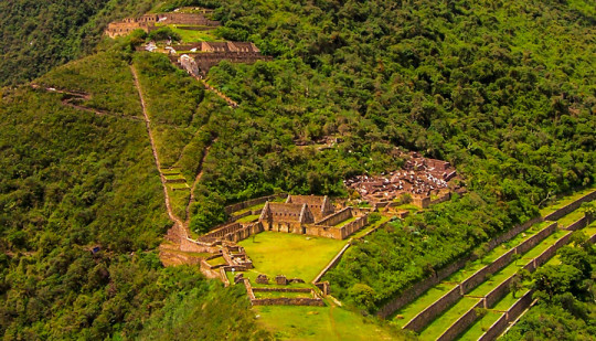
After our breakfast, we will leave early, throughout the day we will see a wide variety of bromeliads, orchids and stands of bamboo; we’ll also hope see birds such as Andean Quetzals, Toucans an a variety of hummingbirds. From our campsite we walk around 1 hour in order to descend to the bottom of the Canyon, called Playa rosalina and the magnificent Apurimac river (1550 m./ 5084 ft). From here we will begin probably the hardest section of the path due to the ascension; 2 hours steep climb to Santa rosa (2095 m. / 6873 ft.) where We will have time to take a refreshing break. From Santa rosa we will continue uphill for another 2 hours towards marampata (2913m / 9557ft), a flat ground where we can have a break and enjoy the views of Apurimac Canyon and the famous Inca site of Choquequirao. Here We’ll have lunch and take advantage of the facilities (toilets and wash room).After lunch We will continue to hike for another one hour to reach our campsite which is located just outside of the Great Inca Site Choquequirao (3110 m. / 10120 ft.) and We will spend the late evening in the ruins, where we will see a very nice sunset over mountains, and if we may be lucky enough to spot Condors soaring nearby over the valley below. Camping at Choquequirao campsite (bathrooms and cold water showers are available).
DAY 3: CHOQUEQUIRAO RUINS – CHOQUEQUIRAO PASS – MAIZAL
After our early breakfast we will visit the mysterious Inca site of Choquequirao, where our professional Tour Guide will explain about the history of this magnificent Inca site. Originally discovered in the 17th century by the Spanish, it lay abandoned and forgotten until recent years when tourism raised the profile of the city and exploration began. Even with this increased interest only 25% of the city has been explored and many of its secrets still wait to be discovered. Actually we can visit the most important zones such as the main plaza, the inca houses, the granaries, the ceremonial sector and its altars, the famous terraces, and the great Llama sector where Incas represented this sacred animal on their buildings. After our guiding visit, you have extra time to explore and enjoy the place by yourselves, after this, we continue with our trail, we will begin walking uphill until the highest point for this day called Choquequirao pass located at 3,300 masl. or 10,890 ft., then we will descend until to the deepest point of the small canyon known as White River or Río Blanco (1900m/6234f), On the way we will pass by Pinchiunuyoj, a small archaeological site. From Rio Blanco we will climb up for about 3 hrs. and during this time we will observe different species of birds, different varieties of orquids, and local coca plantations, we continue hiking until our campsite at the place called maizal (3000 masl. / 9900 ft.).
DAY 4: MAIZAL – SAN JUAN PASS – YANAMA
Today after a very good breakfast we will start a superb day’s hike on a path surrounded by vegetation and flowers climbing by 3 ½ hours along the way you will see evidence of mines that at one time were exploited, but are no longer used. As we continue and ascend, the weather will become a little colder and we will find the remains of an Inca trail. This trail will take us toward the pass called San Juan Pass (4200m/13,780ft). From this beautiful place you can see a great landscape with a grand chain of mountains such us Sacsarayoc, Pumasillo and Choquetecarpo, from which some of the latter peak more than 5000m/16404 feet. You will also see glaciers and many mountains that surround it. After some pictures and a break at the San Juan Pass, we’ll head down and in the distance another recently discovered Inca ruin, Corihuayrachina and the equally interesting old silver mines of Mina Victoria, and we continue Descending by 3 hours to the north into the River Yanama Valley, we follow a high trail which traverses steep slopes and provides another excellent opportunity to spot condors. We camp beside the river at the little Andean village of yanama (3530 m / 11,581 ft.). In the afternoon once again our cook will prepare a tea time for us and after a delicious dinner.
DAY 5: YANAMA – YANAMA PASS – TOTORA – COLPAPAMPA
After early breakfast, we make our way out of the Yanama valley, as we ascend we return to a more barren environment where only the local grasses and hardiest plants can survive. we will start climbing slowly to the highest point of the whole trek, this pass is known as yanama pass(4670 masl. or 15410 feet), again the view will be amazing from here, we will be surrounded by snowcapped mountains as the Sacsarayoj mountain and the Padreyoj mountain and if we are lucky we will even see a condor flying., After a small stop, from this pass we make our way down in to the valley and back in to warmer climes. About 1hour beyond the pass we arrive to a small community called totora at 3,630 masl. or 11,979 ft. where we will have our lunch. After lunch, during the afternoon, we will enjoy frequently the view of snowcapped mountains such as Salkantay (6264 m.) and Pintuyu (5450 m.) and we continue going down for another 2 hours to colpapampa (2750 m.) which is where we’ll be camping for the night; when we arrive you’ll notice a change – now that we’re nearly to Machu Picchu the communities are larger and more well supplied, there are also more tourists whom came from the route of the Salkantay trek and they converge at this point.
DAY 6: COLPAPAMPA – PLAYA SAHUAYACU
Our destination today is the village of La Playa about 12km down the valley from Colpapampa. Our route takes us along the Lluskamayo River through an area that is teeming with life and that has various coffee and fruit plantations. Tonight we will stay at the village of La Playa (2400m / 7874ft.) which is well connected and there are plenty of places where you can buy snacks and refreshments, you can also try some of the locally grown coffee. If you are interested there is the option to visit some hot springs that are close by, let your guide know in advance so that he can organise this for you.
DAY 7: LA PLAYA – HYDROELECTRIC STATION – AGUAS CALIENTES TOWN
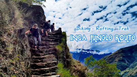
Today is your last hiking day. It will end around lunch time. This climb along the Inca Trail takes about six hours. It is three hours uphill, along the hillside with great views of the Santa Teresa Valley and some coffee and passion fruit farms. Once we arrive at the top of this mountain, we will be at the famous Inca site of Llactapata, which was built by the Incas. They used it to observe the sunrise during the winter solstice. You will also see Machu Picchu for the first time from this location, as well as views of the surrounding areas, such as, the valleys and mountains of Machu Picchu (Huayna Picchu and Machu Picchu Mountains). Then, we will walk the last three hours, descending down to the hydroelectric station. Here, we will enjoy our last lunch and say goodbye to your trekking chef. You will retrieve your duffel bags and catch the train around 3:30 p.m. After a one hour ride to Aguas Calientes, you will be taken to your hotel for a hot shower. If you would like, you can visit the famous hot springs at Aguas Calientes (the entrance fee is $3 per person), then enjoy dinner at a restaurant.
DAY 8: AGUAS CALIENTES - MACHU PICCHU - CUSCO
This day will be for sure the most fascinating for you, because you will see Machupicchu in all its glory from dawn. We get up at 5:00 am and after our breakfast we will go to the bus station for boarding the first bus that leaving at 5:30 am to be in Machupicchu at 6:00 am. Inside Machupicchu we will have 2 hours guided tour where you will visit the most remarkable places such as: el torreón semicircular, el templo de las tres ventanas, el intihuatana, el templo del cóndor, la sala de los morteros y el baño del inca. Then you will have free time to explore Machupicchu by your own or descend to Aguas calientes (Lunch in not included). In the afternoon you will board the train from Aguas calientes to Ollantaytambo, place from where you will be transported by touristic bus to Cusco. Estimated arrival to Cusco (20:00 pm).
Enjoy a half-day mountain bike tour on Abra Malaga in the Sacred Valley of Peru. This trip is a stunner. During the 5,000 feet of all-downhill biking, you will likely see herds of llamas, the massive glacier of Veronica, waterfalls, and authentic Andean lifestyles of simple stone huts and potato farms. This is the continental divide of South America, since, from here going eastward it drops nearly 20,000 feet down to the Amazon jungle basin, and the views here are outstanding. This section of highway has been described by many as one of the most beautiful in South America. By far one of the most popular mountain bike trips in the area, and with very good reason – it is over 5,000 feet of pure descent on a beautifully paved road.
Your tour starts in Ollantaytambo from where you'll drive one hour up the road to the pass of Abra Malaga, which lies at nearly 14,500 above sea level and at the foot of the massive glacier of Veronica (17,500 feet). From there, you begin a 50 kilometer descent that is one of the longest possible in the world, through gorgeous terrain. This ride is all downhill on a smooth paved road, and is truly suitable for anyone who can ride a bicycle. We have done this trip for nearly ten years and have successfully completed it hundreds of times.This ride fun. Everyone who does it loves it, due to the culture and scenery. It is a great mountain bike ride, perfect for those who love mountain biking. For those with extensive off road experience, there is a international DH course just meters away from the main road (extra cost and logistics are involved, ask for details).
LARES TREK
The Lares Trek is an off-the-beaten trail that begins near the town of Lares, 40 miles north of Cusco and 35 miles south east of Machu Picchu (see map below). The trek itself lies in the Lares Valley, east of the Urubamba mountain range, which traverses part of the Sacred Valley.
The trek can be completed as a standalone 2 or 3 day trail, or be incorporated with a visit to Machu Picchu - extending the tour by 1 or 2 days. The latter option is fast becoming a popular itinerary for trekkers due to the limits of the Classic Inca Trail to Machu Picchu.
Permits are not required for the Lares Trek. This means that you will arrive in Cusco and depending on the season (not June-August).
Of course you will need to book your train tickets to Aguas Calientes as early as possible during peak season, as well as your entrance tickets to Machu Picchu.
In terms of the current route itinerary, there are in fact a number of variations on the Lares Trek, most end at Ollantaytambo.
From here trekkers can catch a train to Aguas Calientes to visit Machu Picchu or indeed return to Cusco. We discuss each Lares Trek route variation in some detail below.
There are a number of factors that make this trek to great alternative to the Classic Inca Trail.
Firstly, and perhaps most importantly for some, that is a lot quieter than than Inca Trail.
Secondly, the route is arguably easier than the Inca Trail in that one does not need to deal with as many steps.
Altitude is still an issue and on some route you will need to deal with 3 high altitude passes that are over 4,200 meters (the highest, depending on your route is either 4,400 meters or 4,600 meters).