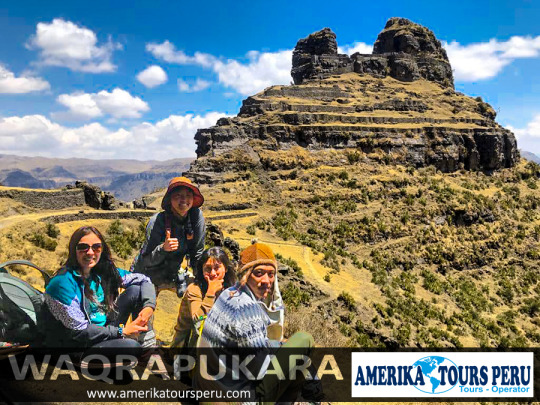
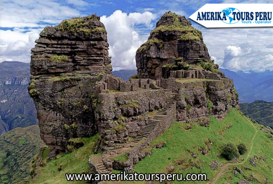
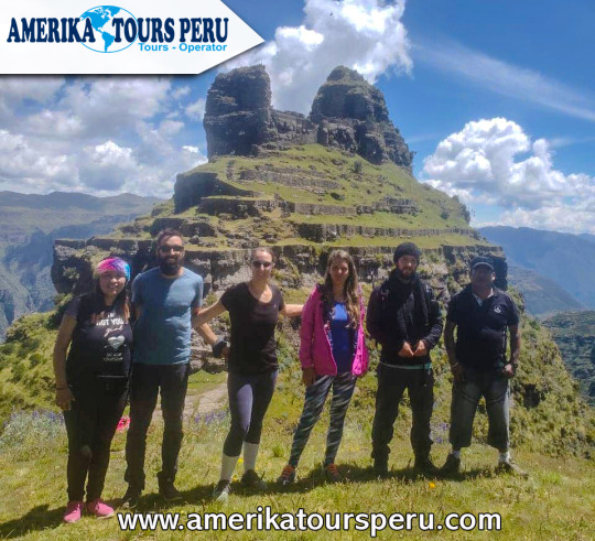
Waqrapukara is a new tourist attraction that remains almost unknown until today. The tour is suitable for those seeking a spirituality that is drowned in the sea of commercial tours. Waqrapukara is a pre-Inca archaeological complex located in the Acomayo province within the Cusco region, near the Apurímac River. The main construction is located on platforms, squares and a so-called «Bosque de Piedras». From its height of 4,140 meters above sea level, it offers spectacular views of the Apurímac River and the Andes.
WAQRAPUKARA TOUR ITINERARY
Its name comes from Quechua, "waqra" means horn, while "pukara" means fortress. Therefore, the meaning of the name translates as a "horned fortress" given by its typical form. However, the locals also called it "Llamapukara", as they claim that the shape does not represent horns, but ears of a lama.
It was built by the pre-Inca Qanchis culture in the period called "Auqaruna" (1,500 BC - 1,000 BC). During this period, the complex was a city called "Llaqta Pukara" and home to a leader of the Yankees. It also served as an astronomical observatory and sanctuary for the god "Teqci Pachakamaq Wiraqocha" (a creator of all created things). Subsequently, it was conquered by the Incas, who have molded the buildings to geography during the reign of Wayna Qhapaq. Then it became a first-class Inca sanctuary that symbolizes an immense political and religious power that has not yet been confused. In 2017, the complex was declared Cultural Heritage of the Nation by the Ministry of Culture of Peru.
Waqrapukara Archaeological Complex. Cultural Heritage of the Nation of 2017.
It was built by the Qinchas and later conquered by the Incas. The building is located on platforms, squares and a stone forest, it would be an Inca sanctuary. Waqrapukara has a privileged view of the Apurímac River.
Waqrapucara details
Maximum Altitude: 4,140 meters / 13,580 feet
Minimum Altitude: 3,096 meters / 10,157 feet
Duration of the walk: 6 hours
Trekking distance: 15 km / 9.3 miles
Difficulty: Moderate
Weather: Cold
Waqrapukara is the archaeological monument located in Acos, Acomayo province in Cuzco, which has been declared a National Cultural Heritage by the Vice Minister of Cultural Property. This Inca monument is located on the slopes of Mount Kenter, has a privileged view of the Apurímac River and has two groups of buildings.
The first group is located at the top, in the middle of a rocky dam, where you can see two enclosures separated by a wide central space. The enclosures have halls, ornamental niches and doors with double jambs; its architecture seems to be similar to that of other ceremonial buildings.
The second enclosure is located at the bottom, and has 8 platforms 153 meters long and 1.80 meters high, which correspond to the topography of the terrain.
Some inhabitants of Acos also call it Llamapukara; and although its origins go back to pre-Inca times, its foundations were built by the Q’anchi, and the Inca construction was built during the sovereign period of the Tahuantinsuyo Wayna Qhapaq. MORE CUSCO TOURS.
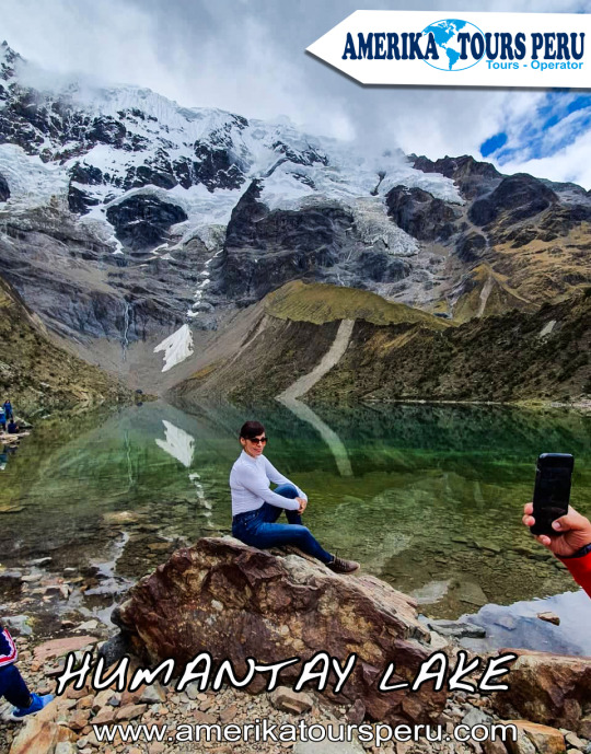
The Humantay Lagoon is the most beautiful lake in Cusco, and it certainly surprises us every day, it is a turquoise lake and is in the middle of the Andes mountains.
The Humantay lagoon is formed as a result of the snow thaw of Humantay, part of the Salkantay mountain.
What differentiates the Humantay Lagoon from other lagoons, is the natural color that it has because not having much marine flora in its waters it has an indescribable color in words, but understandable to the eye.
It forms a unique landscape, where travelers seek to capture the ideal moment with their cameras capturing a wonderful and magical landscape at the same time.
All this and more makes Humantay a place visited by all the tourists who visit Cusco.
Location
Lake Humantay is 2 hours walk from the community of Soraypampa, in the district of Mollepata, province of Anta, department of Cusco, about 2 hours by car from the city of Cusco.
How to get to Humantay Lagoon?
To get to this natural wonder you will have to take a car from Cusco to Mollepata, at the Arcopata bus terminal for about 2 hours.
After breakfast you have to hire the services of a taxi driver to take you to Soraypampa, the taxi will charge you an approximate rate of S / 20.00 and if by chance there are more people who want to go it will be less.
Then you must pay the entrance to Lake Humantay (S / 10.00).
After arriving in Soraypampa you will have to walk at least 2 hours to reach the Laguna (if you do not want to walk you can rent a horse), the first 30 minutes of walking are half flat and the rest is already uphill.
You have to keep in mind that you will probably not find mobility to return, so I recommend that you agree with the taxi driver to wait for you or come to pick you up, there you will enter into your abilities to negotiate prices.
If you cannot find mobility, there are accommodations that range from 20 to 40 soles, there are also camping areas (take your tent) where you can stay. If you plan to camp, make sure you are well wrapped, since it is very cold at night.
Waqrapukara is a new tourist attraction that remains almost unknown until today. The tour is suitable for those seeking a spirituality that drowns in the sea of commercial tours. Waqrapukara is a pre-Inca archaeological complex located in the province of Acomayo within the region of Cusco, near the Apurimac River. The main building is located on platforms, squares and a so-called "Stone Forest". From its height of 4,140 m.a.s.l., it offers spectacular views of the Apurimac River and the Andes.
Its name comes from Quechua, "waqra" means horn, while "pukara" means strength. Therefore, the meaning of the name is translated as a "fortress with horns" given by its typical form. However, the locals also called it "Llamapukara", since they claim that the shape does not represent horns, but ears of a lama.
It was built by the pre-Inca Qanchis culture in the period called "Auqaruna" (1,500 BC - 1,000 BC). During this period, the complex was a city called “Llaqta Pukara” and headquarters of a leader of the qanquis. It also served as an astronomical observatory and sanctuary of the god "Teqci Pachakamaq Wiraqocha" (a creator of all created things). Later, it was conquered by the Incas, who have molded the constructions to geography during the reign of Wayna Qhapaq. Then it became a first-class Inca sanctuary that symbolizes an immense political and religious power that has not yet been baffled. In 2017, the complex was declared Cultural Heritage of the Nation by the Ministry of Culture of Peru.
Waqrapukara Archaeological Complex. Cultural Heritage of the Nation of 2017.
It was built by the Qinchas and then conquered by the Incas. The building is located on platforms, squares and a stone forest, it would be an Inca sanctuary. Waqrapukara has a privileged view of the Apurimac River.
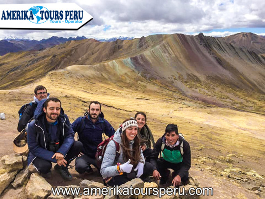
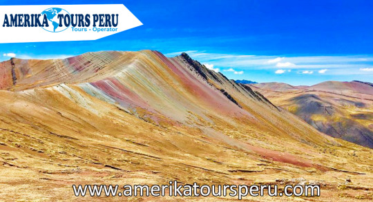
This mountain range is the cousin of the already famous Vinicunca but with better accessibility. Its more than nine thousand natural hectares have a rainbow-like color, which gives it a cheerful and mystical atmosphere. In addition, on your tour you will appreciate a forest of stones, ideal for nature lovers.
This attraction is relatively new and many people in the region did not know it, since it was previously covered by snow, which did not allow to see its coloration; However, due to global warming, the snow has disappeared and it is now possible to appreciate the range of colors in Palcoyo.
An hour and a half south east of Cusco, this natural beauty offers the possibility to see the evolutionary process of the road system in time through three bridges located at the same point, such as the Inca, Colonial and Republican. It also offers a colonial Temple with fine works of wood carving, gold leaf and houses paintings of the Cusco school.
Why is it called Mountain of the 7 Colors? - According to various investigations done on site, the multicolored shades are due to the different minerals that the area covers in capable. These natural substances began to form 65 million years ago when water and rain covered their slopes and peaks. With the passing of time, the extreme weather was thawing the snow that formed there revealing to the world what is today one of the most important tourist attractions of Cusco.
Location and height - This amazing place is located in the Andes of Peru, in the department of Cusco and Canchis province, at 5,200 m.a.s.l., an area of considerable elevation. It belongs to the people of Pitumarca who call it the ‘Cerro Colorado’. Because it is located on the way to the imposing snowy Ausangate, this site was known long before by the adventurers who dared to do the trek. The photos they posted on Facebook and Instagram, made him gain popularity. Since 2016 it is a popular tourist attraction. How to get? - Due to its location, just over 100 kilometers from the city of Cuzco, this place is reached by car in the first instance. After a trip of approximately 2 hours along the Longitudinal Highway of the Peruvian Southern Sierra, you will arrive in Pitumarca. The journey continues along a path to the community of Pampa Chiri. From there, a route is followed by mountain slopes. This journey is 5 kilometers and can be done on foot or on horseback to finally arrive at Vinicunca. There are tours that offer this service.
Climate - The climate, typical of the highest areas of Cusco, is cold. Rain, wind and altitude sickness (or soroche) can be the biggest obstacles for travelers. Temperatures can lower zero degrees Celsius. The best time to do this adventure is during the dry season (from April to October) when river rainfall is less likely. If you plan to visit during the rainy season (from November to March), carry a rain poncho with you. Flora and fauna - The incredible geography of the place is the scene of typical animals from high Andean areas such as llamas, alpacas and vicuñas. The inhabitants of the area raise horses to offer them as transportation to visitors. Due to the height of this region, the ichu or natural boil of the Andes abounds.
Once again the region of Cusco surprises us with a new wonder in its territory, the wonders that this region possesses are incalculable since it was the cradle of the vast and majestic Inca Empire, what we have left is to delight our view, to be amazed at the great architectural ingenuity of the Incas and of course take care of these wonders, the great legacy left to us by these fascinating men, now it's time to admire the mysterious wonder of Waqrapucara.
The name Waqrapukara comes from the Quechua voices: Waqra which means "horn" and Pukara which means "Fortress", we can deduce then that Waqrapukara means "Fortress of the horns", but there is an observation of this interpretation by the locals that indicate that the fortress has no horns, but that they are “the ears of a flame” adducing that it is always alert to what happens around it, therefore, they call it “Llamapukara”
The curves on the carved stone terraces seem to hold the Waqra, which resembles a double-billed crown. In the middle of it, there is a natural cave with Inca intervention and a small window that overlooks the abyss, which also allows a magnificent view of the night sky, populated with constellations, planets and stars of enormous value in the Inca worldview. It is at the top of a huge forest-covered ravine that crowns the chasms that overlook the Apurimac river canyon, the archaeological monument is surrounded by impressive platforms, squares and a forest of stones that resemble thrones, with mythological giants contemplating the mountain landscape.
You can do the tour to Wacrapukara through a walk that lasts about 1 hour and a half, whose difficulty is medium, it is not difficult and the effort will always be worth it when you get to observe the incredible architectural beauty, you can also do mountain biking since the nature of the place lends itself to this activity.
It was considered Cultural Patrimony of the Nation in 2017, we can affirm that Waqrapukara has nothing to envy to the best cultural tourism, adventure and high mountain destinations as well as an archaeological monument is a wonder, but we must add the landscape impact of its surroundings and the spectacular stone formations, when you arrive, the first thing is the astonishment, the landscape that surrounds Waqrapukara is one of the most spectacular in the Andean world. The high plateau wasteland is interrupted by the edges of an immense canyon. Fierce gusts of wind rise through the chasms forming capricious figures on the tops of the ravine. The Inca architects sought to dominate the landscape without transforming its spectacularity.
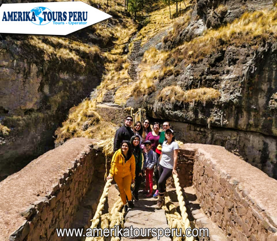
Every first half of June, a bridge disappears to be raised again. It is that of Queshuachaca, in Quehue, the only one in the world made with fibers of the ichu plant, following the most ancestral Inca tradition.
Every time they talk to us about Cuzco, it is usual for our mind to travel to the wonderful Inca city of Macchu Pichu. However, this region of the Peruvian Andes not only stands out, as far as archeology is concerned, for this lost city, considered one of the wonders of Humanity. There are other places that are well worth a visit and, above all, the pleasure of marveling at their beauty.
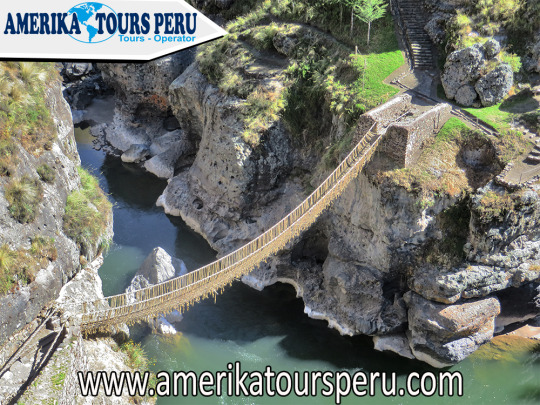
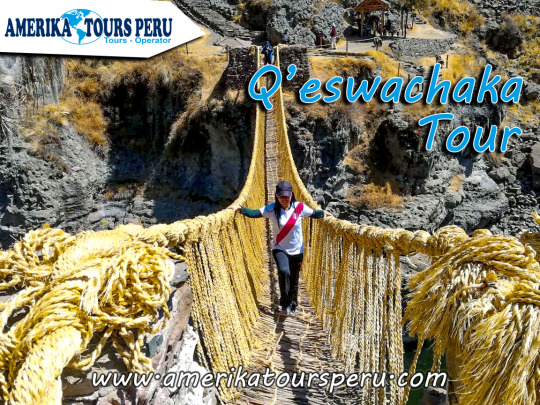
This is the case of the Queshuachaca bridge, also known as Q’eswachaka. It is not a construction at the time of circumventing the canyon that forms the Apurimac River, in the district of Quehue, one of the main rivers of Peru. On the contrary, it is an attraction, while it is the last standing Inca bridge built with the ancestral technique of tracing rope of vegetable fibers. Specifically, it is made of ichu and q'oya (straw straw) sojillas, materials strong enough to allow it to be crossed over it without precipitating from the 50-meter drop on which it is suspended, between two boulders of one of the deep canyons of the region.
With a length of approximately 30 meters, for just over a meter wide, its stability is responsible for thick irons stuck to huge rocks at each end, where the ropes that make up the structure meet. These are braided every year, a tradition that perpetuates the bridge and also ensures that there are no dangers of breakage or falls. Four Quechua peasant communities join annually to restore it, always with the same techniques and materials as their ancestors, a work that earned it recognition by Unesco as Intangible Cultural Heritage of Humanity (the fifth Peruvian element in the list to date) .
The history of the bridge is lost in the Inca oral tradition. It is linked to the road that connected with the Qhapaq Ñan, the great road that linked the four His of the Inca Tahuantinsuyo, in a region where 3,700 meters above sea level are widely exceeded. There, its culmination every year is celebrated with a great party, in what is considered a great work of the Quechua people, united to perpetuate what is now admiration of the entire planet (in fact, the first towns that created the bridge worked together without sharing the same language, a feat).
The material with which it is created is ichu, a natural grass that abounds in the Andean highlands and that, in addition to the manufacture of textile fibers, is used as feed for cattle. Of a raw color, its handmade braids remind that of the ropes that are used in the world of fishermen, and its hardness and worth has been proven for centuries.
The usual thing to visit is through a scheduled excursion that starts from the city of Cusco. It is not too close, so it will take us all day between the trip (round trip) and the visit itself. Of course, in return, in addition to admiring the wonder of Inca engineering, it will be possible to learn about the diversity of the flora and fauna of the Apurimac canyon, as well as the town of Yanaoca, from where we will return to Cusco with, sure, the chamber full of photos and, why not, a few braids of ichu souvenir, which the inhabitants of the same villages who, for centuries, weave a bridge every year, during the month of June, will have woven for us.
Our pick-up will be from 6:50 am in the main square of Cusco, then travel for a period of 3 hours to the station or road tip of the Palccoyoc mountain range, then we will begin the walk of 1 hour maximum to our goal the mountain range and thus to appreciate this beautiful place, we will also visit the forest of stones and the other mountains of colors. Along the route we can appreciate llamas and alpacas as well as local people.
After our visit we will return for a period of 1 hour to our restaurant to have lunch (buffet), the food consists of typical dishes of the area and tourist dishes that will be to your liking and satisfaction, then we will have to return to Cusco in the afternoon Between 6pm we will be in the city of Cusco.
“The Spaniards, upon arrival in the territory of Tawantinsuyo, were amazed and surprised to find themselves in front of a vast network of Inca roads and within them the quality and variety of the bridges. Special mention was given to the suspension bridges made of vegetable fiber or straw that caused not only admiration but also a deserved recognition of the technology used. This admiration caused that throughout the history diverse chroniclers and travelers describe with enthusiasm the Inca work of the straw suspension bridges. The admirable thing is that tradition has kept this ancient technology together with its rituals and the community work system that make it possible for us to have the joy of observing after more than 500 years the validity of the intangible culture of the Incas until I presented". The Inca bridge is located in the peasant community of Huinchiri, in the district of Quehue, province of Canas, Cusco Region.
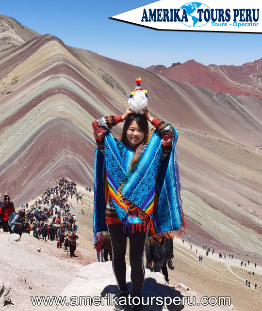
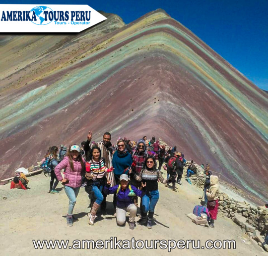
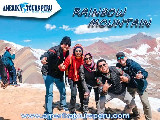
We will start first with the pick-ups starting at 3:00 am (private service) and at 4:00 am (pull service) where we will pass by your hotels, after concluding the pick-ups we will travel for a time of 1 hour and a half to our restaurant (Cusi pata), along the route we can see the sacred river or willcamayu river, which is part of the sacred valley of the Incas. Upon arrival at the camp we will have a rich breakfast (buffet), then we will take the transport again to continue with the tour for 1 hour and arrive at the bus station, where the trek to the mountain of 7 colors (5029m) will begin, Our guide will give you a talk and recommendations to reach the top, after 4km of walking (2 hours), we will reach the top and we will be able to appreciate all the natural attraction of the area, we will have a talk with the guide about why the colors and landscapes in the area and then we will organize the trip to the red valley (optional) to appreciate the beautiful landscape that it offers (5089m), then take the return route to the bus station, once the whole group in the transport, we will return to the camp to have lunch (buffet), and then return to the city of Cusco at approximately 18:00 pm. Rainbow Mountain
Unlike the Inca Trail, the Salkantay trek can be done without a tour, on your own and without a tour guide. To make this walk you must take all necessary precautions.
Follow these recommendations to make the Salkantay trek on your own:
Book the Machu Picchu tickets in advance before making the Salkantay trek. Otherwise, you can return without knowing the Wonder of the World.
The route to follow is the same as the Salkantay trek with tour. The journey on your own may take more or less days, depending on the visitor's ability.
The first step is to reach the town of Mollepata from the city of Cusco. Cars are taken at the ‘Arcopata’ bus terminal, in the city of Cusco.
From Mollepata the ascent begins. It is advisable to carry what is strictly necessary (food for 5 days and sleeping equipment) to avoid carrying excessive luggage. What to wear for the Salkantay trek?
Sleeping bags.
Cap or hat
Trekking shoes
Trekking backpack
Waterproof jacket
Trekking pants
Poncho for the rain.
Canteen with water.
Water purifying tablets.
Sunscreen.
Personal toiletries.
Snacks
Cash.
What does a tour to Salkantay trek include?
In general, tours to Salkantay trek include the following:
Transportation by train from Aguas Calientes to Ollantaytambo.
Bus from Ollantaytambo to Cusco.
Horses to transport luggage (5 kilos).
When is the best time to do the Salkantay trek?
The best time to visit Machu Picchu is in the dry season (from April to October). During those months, there is less chance of rain so the roads are in better condition.
In the dry season, however, the days are sunnier and the nights colder. According to mountaineering experts, June, July and August; It is the best time to do the Salkantay trek. Tips for the Salkantay trek Acclimatize one or two days in the city of Cusco before performing the Salkantay trek. Avoid alcoholic beverages or high fat meals. The altitude sickness or soroche in Salkantay and Machu Picchu is one of the greatest difficulties. Perform some exercise prior to Salkantay trek. You don't need to be in excellent physical shape but a little exercise will help. No matter what part of the year, he wears warm clothes during the Salkantay trek. The nights are especially cold in the first two days. Plan up to the smallest detail the Salkantay trek on your own.
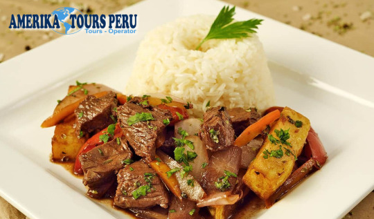
The lomo saltado is a typical dish of Peruvian cuisine. Its origin dates from the end of the nineteenth century, where it was known as "beef tenderloin", "sauteed lomito", "lomito a la chorrillana" or "lomito al juice". It is considered one of the best dishes in Peru.
This delicious dish comes from two cultures: the Chinese and the Peruvian, where it has been able to balance a perfect flavor and color. It is made with beef tenderloin, red and Chinese onions, yellow pepper, sherry and Sillao.
Know the origin of the loin sauteed from Peru Recall that the Chinese began to arrive in Peru in a massive way in 1849, where they brought their condiments and sauces that they sold on the well-known Capón Street in the Center of Lima.
Also, Lomo Saltado is found in all menus of Peruvian restaurants in Miami and in the world, it has become the flagship dish, in addition to ceviche. Without a doubt, it has become a positive contribution to the gastronomic culture of Peru.
It should be noted that the Inca Garcilaso de la Vega reports that the first cattle arrived in Peru in 1538 and when the meat began to be sold it was too expensive. However, it was gradually falling in price. He also states that the first cows should have arrived shortly after the conquest, and that they took time to sell.
The best Lomo Saltado! For this reason, there are not many Peruvian dishes with beef. The sauteed loin is a product of the influences of Chinese culture, which has given very important contributions to the culinary culture of Peru.
Also, Gastón Acurio said in an interview: “It has Inca, Spanish and especially Chinese influence. It has the Asian technique of the pan and sauteed in cooking, giving rise to what we know now as sauteed loin, accompanied by potatoes on a separate plate, in the 40s. Five decades later the potato is incorporated in a single presentation ”.
Today, the sauteed tenderloin is found in the menu of all Peruvian restaurants in the world. Without a doubt, the sauteed loin is one of the most representative dishes of Peruvian cuisine. It is a dish that without the contribution of oriental food, would not have been possible to make.
Contact us: Tours In Cusco
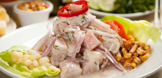
Seviche, ceviche or cebiche, is perhaps one of the most recognized typical dishes it has in Peru; and although its origins are still unknown and disputed by others, it is a culinary delight that has been prepared for many years, making it a representative of Peruvian food.
It is not known exactly what the beginnings of the cebiche were, but several theories are supported that make use of the name, place and even ingredients that were changing as new cultures were involved with the preparation of this traditional dish.
information of tours in Cusco: Amerika tours Peru Travel agency It is believed that more than 2000 years ago on the Peruvian coast, the Mochica culture prepared a dish based on fresh fish, which was cooked with juice from a local fruit, called tumbo; then in the time of the Incas, the fish was macerated with girl, and it was until the arrival of the Spaniards when the ingredients we know today in the ceviche were added: the lemon and the onion. According to the historian Javier Pulgar Vidal, the word "seviche" comes from "siwichi" which is a Quechua terminology that translates as fresh or tender fish. Other versions are also discussed as "cebiche" from the word bait, used to refer to a delicacy or food. Turning to other languages, it is suggested that ceviche comes from marinade, which is a word of Arabic origin; Likewise, the historian Juan José Vega describes “seviche” from “sibech” which is another Arabic word, and its use is also directed towards acidic food, which tells a story about the arrival of Pizarro and some Moorish women They added sour oranges and then lemon juice to the fish. Despite having spent a lot of time since the knowledge of these ways to prepare the cebiche, the same ingredients remain, such as: white fish in pieces, red onion in julienne, lemon juice, chili, chopped coriander and salt.
he Cusco region, being one of the most recognized destinations, has an indigenous cuisine due to the use of protein-rich products from the area such as: corn, different meats such as alpaca, guinea pig, lamb, pork, etc.
The essence of culinary miscegenation has made the Cusco cuisine well positioned before our visitors.
"Chiri Uchu" This name comes from the union of two Quechua words: Chiri which means "COLD" and Uchu which means "AJI" so we can understand what it is: Aji (or spicy) cold, this is the flag dish of the region of Cusco in the celebration of Corpus Christi.
History:
The chronicles of Pedro Sarmiento de Gamboa, who in 1572 spoke of the "strange" combinations of ingredients that the ancient Peruvians made in the kitchen, suggest that this stew has an Inca origin; especially of the chaskis (young athletes who traveled from one place to another carrying certain messages), since they carried their food in their ch’uspa (purse) and therefore tended to eat it cold.
It is also presumed that he was born of the Aynis (Reciprocal Work System among family members), since at the end of the work day each Ayllu (Family Community) shared the best of his meal with others, thus forming a mixture of foods.
With the arrival of the Spaniards, customs and traditions were replaced with religious traditions, just one of them was the “Corpus Christi”, a Catholic holiday that brings together patron saints and virgins of all the parishes of the city; This is how Chiri Uchu becomes part of the European fusion with Andean traditions.
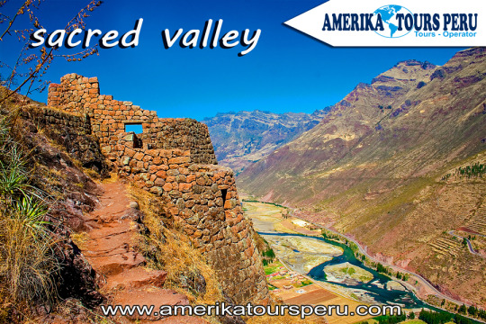
Named for being the main food supplier of the Inca empire, The Sacred Valley sits on the banks of the Urubamba River. This river in its beginnings has the name of Vilcanota, which comes from the Quechua word Wilcamayu or Sacred River. The Incas built archeological centers, along its banks, which replicated the constellations they knew of the Andean sky so that this contributes, even more, to the beauty of this charming valley.
The Sacred Valley of the Incas is located 35 kilometers from Cusco, and about 600 meters below the level of Cusco. It covers the part of the Vilcanota river basin between the towns of Písac and Ollantaytambo.
Between the months of April and October, at night the temperature drops considerably, in the early hours of the morning the tempreratura rises gradually until after noon.
Here are some suggestions of what you can do in the Sacred Valley
Canoeing in the sacred river of the Incas (Huillcamayo or Vilcanota). Appreciate and buy handicrafts at the famous craft fairs in Pisac, Ollantaytambo and Chinchero. Tour Moray, impressive agricultural laboratory of the Incas.
During the time of the Incas there was a great network of roads called “Camino Real” to unite the Inca empire. However, due to its rugged geography many places were joined by suspension bridges made of vegetable fiber.
The Qeshuachaca is the only bridge that has been renovated from generation to generation by the families of Cusco until today. The bridge is located in the department of Cusco, over the Apurimac River at 3,700 m.a.s.l. About a thousand people from different communities, near the bridge, meet for four days to renew it.
Now, we will know the four days of tradition that delays the reconstruction of Queshuachaca: On the first day, the inhabitants of the communities leave in search of a solid straw of vegetable fiber called Ichu in Quechua. Once the necessary amount of Ichu has been collected, the women weave this solid straw to form the ropes of the bridge, and the men are in charge of joining the rope from end to end and then braid it.
When the second day arrives, the structure of the old bridge is taken apart, the stone nails that support the bridge are removed, and four ropes are placed, which are the base of the structure of the new bridge. Tired, but with strength, on the third day, the villagers conclude with the assembly of the handrails and the bridge surfaces where the communities will cross.
Queshuachaca Tour And finally, on the fourth day, they celebrate the reconstruction of the bridge to the sound of music with native dances, since the work is considered as a holiday by Peruvian ancestors.
Ausangate is the fifth highest mountain in Peru, with its 6384 meters high, located in the Pitumarca district, Canchis province, Cusco region, in southern Peru; Ausangate is considered the most important mountain in the Andean worldview.
The “Apu” Ausangate is for the Andean culture, life giver and guardian of one of the most varied ecosystems in the world; Its name means "copper" in Quechua. When you are on this mountain, remember that it is sacred to local people; In fact, many of the nearby Andean communities still have pilgrimage dates to the top of the mountain. As the community of Chillca; of shepherds of llamas and alpacas, which have inherited Inca and pre-Inca cultural traditions. It is possible to share the daily life of the shepherds and work with the llamas. RAINBOW MOUNTAIN TREK
Climate change has discovered the multicolored beauty of these mountains located in the Vilcanota, Vinicunca or Winicunca mountain range, also called Seven Color Mountain, Rainbow Mountain or Mountain of Colors (the inhabitants call it Cerro Colorado) is a mountain of Peru with a altitude of 5,200 meters above sea level and owes its incredible coloration to the richness of minerals that houses its soil, the Winikunka mountains are behind the imposing snowy Ausangate.
A walk through these parts constitutes a very special experience, combining the fact of being at such levels with the enjoyment of an outdoor activity and the contemplation of a visual wonder.
Leaving the city of Cusco, you drive along the Longitudinal race of the Peruvian Sierra del Sur in the direction of the town of Checacupe where you take the fork towards the town of Pitumarca, and from this town you travel the journey through a carrosable trail passing through several rural communities such as Ocefina, Japura, Hanchipacha, until arriving at the community of Pampa Chiri, where the road ends and the 5km walk begins approximately until the Vinincunca pass. where you can see the Natural Formation in the shape of a Rainbow, considered the Mountain of Colors.
The Sacred Valley for the Incas With the river feeding the valley, its fertile lands were one of the main centers of food production during the time of the Incas; Some places, such as Moray, were used as agricultural laboratories, to experiment with species of plants brought from across the empire. The Incas cultivated potatoes, white corn, coca, fruits and vegetables, on terraces like those that can be seen in many valley villages specially designed for this purpose. Today the valley produces lucuma, peach, avocado, and one of the best corn grains in the world.
But it was more than just an important agricultural center; The Urubamba River Valley, "Willcamayu" for the Incas, was one of the most important elements in the religious cosmology of the Incas. They believed that the flow of the Urubamba was closely linked to constellations and mountains, they also believed that it was the counterpart of the milky way on earth.
information: Machu Picchu Tour
Where is the Sacred Valley of the Incas? The Urubamba river valley or "Sacred Valley of the Incas", is located 15 km northeast of the city of Cusco, is reached by a paved road. A trip by car to one of the nearest villages will take around 40 minutes. From there you can move to the other villages in the valley. What is the weather like in the valley? The Sacred Valley of the Incas is 2,800 m.s.n.m., 600 meters below Cusco, and enjoys one of the best climates in this region, daytime temperatures vary between 19 ° and 24 ° C. This privileged climate made the Incas take it as their main center of agricultural production, experimentation and research. Nowadays, travelers use the valley to acclimatize themselves, before starting their tours through Cusco and Machu Picchu, and without a doubt one of the best ways to avoid altitude sickness. What to see in the Sacred Valley of the Incas? Known by the Incas as Willcamayu, the beautiful valley extends from the town of Pisac to Ollantaytambo, along the Urubamba river. The ancient Inca settlements in these cities are presented as checkpoints, before entering the "Inca Trail" that leads to the sacred city of the Incas, Machu Picchu; They are simply amazing, and one of the best before what you will see in wonder. Pisac The town of Pisac is located 33 kilometers from the city of Cusco and is presented as the door to the Sacred Valley. It is world famous for its craft market and its impressive archaeological remains, located on a mountain above the town. This town was a kind of capital of the region in the time of the Incas, very important for its excellent location and its fertile lands. The Inca and colonial constructions that are exhibited in its territory, are admirable for its great bill and for the platforms that surround the mountains and polished stone structures, assembled to perfection. On the other hand, the people of Pisac has become the spiritual center of the Sacred Valley, in it you can have all kinds of experiences and spiritual retreats, in addition to meeting people from all over the world interested in this. Urubamba Urubamba is one of the most important cities in the valley today, it is a city that was born during the colony and is considered the world capital of corn. This is possible because it is watered by numerous rivers that are born in the peaks of the glacial mountains; This whole territory was highly appreciated by the Incas due to the fertility of their lands and the great qualities for cultivation. It is one of the best places to relax in the valley, you will see many foreigners, but beware, they are not tourists, they are people who left their countries and decided to stay in this cozy town. Ollantaytambo Ollantaytambo, also known as Ollanta, is located 97 km northwest of the city of Cusco; approximately 2 hours and 30 minutes by car. It was during the time of the Incas a fortified city, with temples, urban, agricultural and defense walls. It is known that the Inca city of Ollantaytambo served as an administrative checkpoint. After the Spanish invasion, it became one of the favorite places of the viceroys. It is considered one of the most important archaeological sites in Peru and South America; In addition, many people consider that after Machu Picchu, the town and the ruins of Ollantaytambo contain the most impressive Inca stone work in Peru; However, it is not the only amazing thing about this place. Only a few years ago, global positioning systems allowed us to discover that Ollantaytambo is aligned with other ancient constructions throughout the world; the pyramids of Gíza, the Easter islands, the Nazca lines, are just some of them; In addition, the most important archaeological remains around the world are aligned around this line. We recommend you visit the Inca city of Ollantaytambo, otherwise, you will be missing out on something very big. Chinchero On a normal tour of the Sacred Valley of the Incas, the town of Chinchero will be the one you will visit after touring most of the valley, back to Cusco; It is located 28 km from the city of Cusco at 3,772 m.a.s.l. and it has important archaeological sites, a beautiful 17th-century colonial church with canvases of the "Cuzqueña School", and a typical market where bartering can still take place.
The llaqta (city) of Machupicchu is an Inka political, religious and administrative center, which includes temples, platforms, houses and water channels.
Where it is located? The llaqta of Machupicchu is located in the district of Machupicchu, province of Urubamba, of the Cusco region, at the height of km. 112.5 of the railway line and it was a graben between the mountains of Machupicchu and Waynapicchu.
History and architecture Built during the first half of the fifteenth century, Machupicchu is divided into two large areas: the agricultural one that comprises a vast network of artificial terraces or terraces, and the urban one formed by various constructions and squares among which the temples of the Sun, of the Three Windows, of the condor and the main temple.
Important data: - The Historic Sanctuary - Machupicchu National Archaeological Park was included in the UNESCO World Heritage List as a mixed cultural and natural heritage, due to its exceptional universal value, considered as an important political, religious and administrative center of the Inca era.
- Its temperature ranges between 6.2 ° C 29.5 ° C, since it is located in a subtropical zone. Its rainiest months are from November to March.
- Its majestic architecture comprises about 140 structures throughout the Inka llaqta.
- The average altitude of the llaqta is 2 450 m.a.s.l.
- His scientific discovery is attributed to the researcher Hiram Bingham, who was in search of the last capital of the Incas of Vilcabamba.
- Machupicchu was declared "Historic Sanctuary of Peru" in 1981. General data
Machupicchu means old mountain, named for the location of the llaqta inka.
The architectural complex was built in the mid-fifteenth century and according to historians it would have been built at the request of the Pachakuteq inka.
The exact location is in the Machupicchu Pueblo district, province of Urubamba, 112.5 km northeast of the city of Cusco.
Machupicchu was interconnected with the entire Inka empire through the Qhapaq Ñan, known as the Inka Road Network.
Its annual temperature is 6.2º C minimum and maximum of 29.5º C.
The llaqta of Machupicchu has two defined zones: agricultural zone formed by the platforms and terraces, and the urban zone that fulfilled administrative functions.
The average altitude of the llaqta is 2,450 meters above sea level.
The mountains of Waynapicchu and Machupicchu are ideal for panoramic photographs of the entire archaeological complex.
Entrance Tickets Due to the growing flow of tourists who wish to visit the Machu Picchu Inka Llaqta and to ensure that their experience is memorable, it is recommended to organize the visit well in advance, for which the following should be taken into account:
• Buy tickets to enter Machupicchu in advance, for limited daily capacity, check availability at www.machupicchu.gob.pe (only official page). • In case you cannot make your purchase through the website you can make it in person at the ticket offices of the Deconcentrated Directorate of Culture Cusco - DDC, located at Calle Maruri N ° 340 (Palacio Kusicancha) and Calle Garcilaso s / n (side of the Regional Historical Museum) from Monday to Saturday between 07:00 - 19:30 hours (does not attend holidays). The sale of admission tickets is subject to availability. • The Decentralized Directorate of Culture in Machupicchu Pueblo is the last point of sale, so a last minute purchase will mean subject to the availability of remaining spaces in the system, also the payment is only in soles and cash. Credit cards, debit cards or payment in dollars are not accepted. • The purchase of a student ticket is in person or through a travel agency prior to the presentation or remission of a valid student card. ISIC card is not accepted. • Entry to SHM - PANM is from the time indicated on the ticket, so early admission is not allowed. • Bring printed the entrance ticket to Machupicchu. • Before entering the llaka inka make use of the hygienic services, since the visit will last an average of 2 to 4 hours (There are no hygienic services within the llaqta). • Re-entry is only allowed for visitors who have a visit to the mountains of Machupicchu and Waynapicchu, and entrance tickets for the mountains can be purchased in advance through the website www.machupicchu.gob.pe, they are also subject to availability, taking into account that the maximum allowed entry capacity is 400 visitors per day for each mountain, divided into two groups of 200 visitors per shift.
The Suspension Bridge in Cusco declared universal heritage, also known as the bridge of the Inca Queswachaca; It is one of the most impressive legacies that can be seen these days, know this suspension bridge in Cusco, where the inhabitants still maintain and renew every year.
Empire of the Incas, fulfilled a very important function of unique cocexion with the other end even until the arrival of the Spaniards where the Queswachaca Bridge had resistance to pass a whole group of Spanish battalions.
More Information: Queswachaka tour
Hanging Bridge Cusco or Q'ueswachaka It comes from the Quechua word means Q'ueswa = Braid, Chaka = Bridge, the bridge is located above the Apurimac river, which is 15 meters high, the Q'ueswachaka bridge belonged to the network vial del (Q'apac Ñan), which is located on the route of the South Valley.
Our staff will be happy to help you complete your visit to this beautiful place, on our tour, we will also visit the 4 lagoons of Pomacanchi, Acopia, Asnapcocha, Pampamarca, our guide will make a detailed explanation of the importance of these places.
Therefore, if you are in Cusco do not hesitate to visit, the Q’ueswachaka Bridge 2019, it will be a great experience of all your trips.