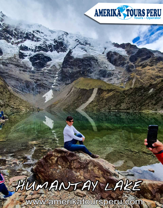
The Humantay Lagoon is the most beautiful lake in Cusco, and it certainly surprises us every day, it is a turquoise lake and is in the middle of the Andes mountains.
The Humantay lagoon is formed as a result of the snow thaw of Humantay, part of the Salkantay mountain.
What differentiates the Humantay Lagoon from other lagoons, is the natural color that it has because not having much marine flora in its waters it has an indescribable color in words, but understandable to the eye.
It forms a unique landscape, where travelers seek to capture the ideal moment with their cameras capturing a wonderful and magical landscape at the same time.
All this and more makes Humantay a place visited by all the tourists who visit Cusco.
Location
Lake Humantay is 2 hours walk from the community of Soraypampa, in the district of Mollepata, province of Anta, department of Cusco, about 2 hours by car from the city of Cusco.
How to get to Humantay Lagoon?
To get to this natural wonder you will have to take a car from Cusco to Mollepata, at the Arcopata bus terminal for about 2 hours.
After breakfast you have to hire the services of a taxi driver to take you to Soraypampa, the taxi will charge you an approximate rate of S / 20.00 and if by chance there are more people who want to go it will be less.
Then you must pay the entrance to Lake Humantay (S / 10.00).
After arriving in Soraypampa you will have to walk at least 2 hours to reach the Laguna (if you do not want to walk you can rent a horse), the first 30 minutes of walking are half flat and the rest is already uphill.
You have to keep in mind that you will probably not find mobility to return, so I recommend that you agree with the taxi driver to wait for you or come to pick you up, there you will enter into your abilities to negotiate prices.
If you cannot find mobility, there are accommodations that range from 20 to 40 soles, there are also camping areas (take your tent) where you can stay. If you plan to camp, make sure you are well wrapped, since it is very cold at night.
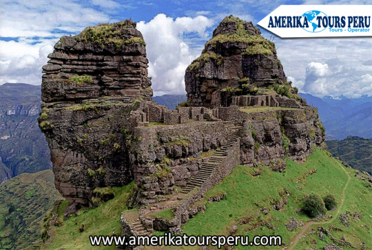
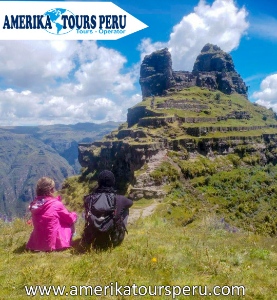
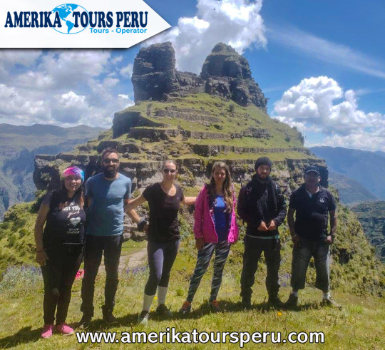
Waqrapukara is a new tourist attraction that remains almost unknown until today. The tour is suitable for those seeking a spirituality that drowns in the sea of commercial tours. Waqrapukara is a pre-Inca archaeological complex located in the province of Acomayo within the region of Cusco, near the Apurimac River. The main building is located on platforms, squares and a so-called "Stone Forest". From its height of 4,140 m.a.s.l., it offers spectacular views of the Apurimac River and the Andes.
Its name comes from Quechua, "waqra" means horn, while "pukara" means strength. Therefore, the meaning of the name is translated as a "fortress with horns" given by its typical form. However, the locals also called it "Llamapukara", since they claim that the shape does not represent horns, but ears of a lama.
It was built by the pre-Inca Qanchis culture in the period called "Auqaruna" (1,500 BC - 1,000 BC). During this period, the complex was a city called “Llaqta Pukara” and headquarters of a leader of the qanquis. It also served as an astronomical observatory and sanctuary of the god "Teqci Pachakamaq Wiraqocha" (a creator of all created things). Later, it was conquered by the Incas, who have molded the constructions to geography during the reign of Wayna Qhapaq. Then it became a first-class Inca sanctuary that symbolizes an immense political and religious power that has not yet been baffled. In 2017, the complex was declared Cultural Heritage of the Nation by the Ministry of Culture of Peru.
Waqrapukara Archaeological Complex. Cultural Heritage of the Nation of 2017.
It was built by the Qinchas and then conquered by the Incas. The building is located on platforms, squares and a stone forest, it would be an Inca sanctuary. Waqrapukara has a privileged view of the Apurimac River.
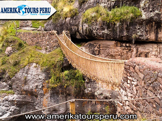
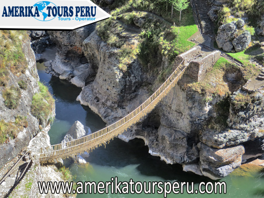
Queswachaca is a rope bridge made with Inca techniques and knowledge which has been transmitted from generation to generation until today for approximately 600 years. The Queswachaca bridge is over the waters of the Apurimac River and belongs to the Qapaqñan road network.
The Queswachaca suspension bridge is known as the last Inca bridge and is located in the region of Cusco, Canas province and Qhuehue district.
If you want to know more, keep reading that on our website you will find the most complete information about Queswachaca
Why the Queswachaca Inca Bridge is important
The Inca bridge of Queswachaca is important as it maintains the ancestral customs of our Inca ancestors and is the last Inca bridge today, every second Sunday of June the Queswachaca Inca bridge is renewed by carrying out 3 days of celebrations which we will detail more in depth paragraphs below.
The bridge is 28 meters long and 1.20 meters wide, the inhabitants of the communities of Chaupibanda, Huinchiri, Choccayhua and Qollana Qehue and its annexes Ccomayo, Perccaro, Chirupampa among others. They build the bridge following the tradition of the Inca Pachacutec, about 800 community members from the aforementioned communities are responsible for the construction of the bridge.
Process for the construction of the Queswachaca bridge
1st day: The first day begins with the celebration of “apu Quinsallallawi”, this ceremony takes place during the dawn, during the celebration of the gathering or gathering of ichu which is braided by the women of the communities and the Work that is being done is supervised by the “chakaruwak” or tissue specialist.
2nd day: The Inca bridge is dismantled via Queswachaca, thus removing the nails of stones that support the bridge, then put the four ropes that is the main support of the bridge.
3rd day: On the third day the laying and braiding is done with the culmination of the traffic zone (Bridge floors) and the handrails of both left and right sides.
4th: day: After the hard work, the culmination of the Queswachaca bridge is celebrated with food and typical dances.
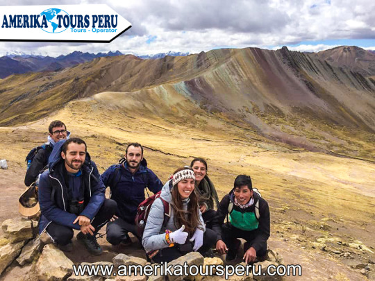
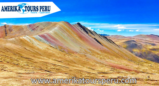
This mountain range is the cousin of the already famous Vinicunca but with better accessibility. Its more than nine thousand natural hectares have a rainbow-like color, which gives it a cheerful and mystical atmosphere. In addition, on your tour you will appreciate a forest of stones, ideal for nature lovers.
This attraction is relatively new and many people in the region did not know it, since it was previously covered by snow, which did not allow to see its coloration; However, due to global warming, the snow has disappeared and it is now possible to appreciate the range of colors in Palcoyo.
An hour and a half south east of Cusco, this natural beauty offers the possibility to see the evolutionary process of the road system in time through three bridges located at the same point, such as the Inca, Colonial and Republican. It also offers a colonial Temple with fine works of wood carving, gold leaf and houses paintings of the Cusco school.
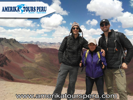
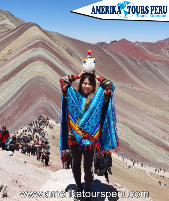
Rainbow Mountain hike Full Day is new route which includes a part of the Ausangate route, it is an adventure that will take your breath away constantly. With a combination of wild mountain landscapes, glaciated peaks, rushing rivers and challenging mountain passes, everything seeming untouched and undiscovered. - Shared Service: S / 70 per person - Private Service: $ 80 p / p (DOLLARS) - With IGV: S / 82.00
Schedule I pick up in Lodgings:
• Private Transportation: 03:00 A.M.
• Shared Transportation: 04:30 A.M - 05:00 A.M
Our adventure begins around 04:30 AM - 05:00 AM (Depending on the service you hired there), picking it up at your respective lodging, to go from Cusco to the town of "Hanchillpacha" (2 hrs. And 30 min. Approx.), Where our restaurant is located, in which you can enjoy our nutritious and energizing breakfast before starting the tour, after this we will get on the car to enter about 25 min. Approximately, and start preparing for the adventure.
We will arrive at the control point and begin our walk, it will be approximately 6 kilometers approximately (2 hrs and 30 min.) To visit the wonderful "Mountain of colors", we will be there approximately 30 minutes, for a brief explanation and to take photographs, to Then return by the same route and get on our transport, which will take us back to our restaurant to enjoy a delicious buffet lunch, which consists of typical Peruvian food.We will be returning to cusco (Private and Shared Service), between 17:30 hrs. at 7:00 p.m., leaving them in the case of private service at your hotel and if it is a shared service in the Plaza Regocijos.
In runasimi "waqra" is horn and "pukara" is the equivalent of strength. Seeing the picture the name is more than eloquent. But the shepherds of the communities of Acos, to the south of the city of Cusco, also know him as Llamapukara: “they are not horns - they assure - they are the ears of a flame that is alert to the presence of foreigners”.
Despite its almost impregnable location - at the top of a peak over the chasms that overlook the Apurimac River canyon and over 4 thousand meters above sea level - at least four old roads lead to this fortress.
Undoubtedly, both "ears" or "horns" found in the fortress were cause for sacralization among its builders. The best preserved are its walls, stairs, terraces and finely carved stone rooms in the best classic Inca style.
For archaeologist Miguel Cornejo, Waqrapukara represents the “architecture of power. It is a first-class Inca sanctuary, which denotes immense political and religious power not yet deciphered, ”says Cornejo. “Before entering Waqrapukara, you reach a space formed by river and wind erosion. The whole natural environment warns from afar that a special place, out of the ordinary, of incomparable beauty is being reached, ”adds the PUCP archaeologist.
Waqrapukara is a good adventure and experiential tourism destination. The truth is that this route does not ask for tourists, it requires expeditionaries.
Unlike other destinations with many visitors, you can camp in the surrounding area in Waqrapukara. I recommend enjoying the night sky. You may find the reason why your former builders chose this magical and mysterious place.
How to get?
One of the routes to reach the Waqrapukara fortress is to go to the Pomacanchi district, province of Acomayo, which is approximately 115 km from the city of Cusco.
Arriving at the Chuquicahuana bridge, which is 92 km away, we head down the road to Acomayo. Arriving at the place called Cebadapata, we find the Pomacanchi Lagoon, which is the first tourist attraction, in this lagoon we can observe fishermen in small boats doing their daily work and the natural landscape with all the fauna and flora of the place.
In front of Cebadapata we can find the archaeological remains of K’ero, bastions, pre-Hispanic andenería, colcas and other constructions. In this way we arrive at Pomacanchi, the Ecotourism Capital of the Cusco Region, in this town we will find the house of Carmen Rosa Noguera, mother of the Caudillo José Gabriel Condorcanqui “Tupac Amaru”, who as we know started the Latin American Independence Revolution.
Why do some promote traveling to Waqrapukara through Pomacanchi?
Because we find attractive places, not only for the archeological remains of K'ero, the pre-Inca constructions in Conchacalla, the Pomacanchi Lagoon, the Huaca de K'ullupata, the vicuna reserve of Pumawasi but also for the fauna and flora, we will find species native such as achanqaray, qantu, chillka, t'ankar, ich'u, qeto qeto, panti, totora and other species. In the fauna we will find: Falcon, kestrel, eagle, condors, vicuñas, puma, deer, fox, skunk. The other advantage is that Pomacanchi is a colonial-style villa, as evidenced by its colonial bridges distributed throughout the district, its church also has accommodations for the traveler, such as the Municipal Lodging that has a dining room. On the way to the fortress we can enjoy the abundant wild vegetation of the area, spectacular view of the Apurimac Canyon and many other beauties.
Undoubtedly, both "ears" or "horns" found in the fortress were cause for sacralization among its builders. The best preserved are its walls, stairs, terraces and finely carved stone rooms in the best classic Inca style.
For archaeologist Miguel Cornejo, Waqrapukara represents the “architecture of power. It is a first-class Inca sanctuary, which denotes immense political and religious power not yet deciphered, ”says Cornejo. “Before entering Waqrapukara, you reach a space formed by river and wind erosion. The whole natural environment warns from afar that a special place, out of the ordinary, of incomparable beauty is being reached, ”adds the PUCP archaeologist.
Waqrapukara is a good adventure and experiential tourism destination. The truth is that this route does not ask for tourists, it requires expeditionaries.
Unlike other destinations with many visitors, you can camp in the surrounding area in Waqrapukara. I recommend enjoying the night sky. You may find the reason why your former builders chose this magical and mysterious place.
Why is it called Mountain of the 7 Colors? - According to various investigations done on site, the multicolored shades are due to the different minerals that the area covers in capable. These natural substances began to form 65 million years ago when water and rain covered their slopes and peaks. With the passing of time, the extreme weather was thawing the snow that formed there revealing to the world what is today one of the most important tourist attractions of Cusco.
Location and height - This amazing place is located in the Andes of Peru, in the department of Cusco and Canchis province, at 5,200 m.a.s.l., an area of considerable elevation. It belongs to the people of Pitumarca who call it the ‘Cerro Colorado’. Because it is located on the way to the imposing snowy Ausangate, this site was known long before by the adventurers who dared to do the trek. The photos they posted on Facebook and Instagram, made him gain popularity. Since 2016 it is a popular tourist attraction. How to get? - Due to its location, just over 100 kilometers from the city of Cuzco, this place is reached by car in the first instance. After a trip of approximately 2 hours along the Longitudinal Highway of the Peruvian Southern Sierra, you will arrive in Pitumarca. The journey continues along a path to the community of Pampa Chiri. From there, a route is followed by mountain slopes. This journey is 5 kilometers and can be done on foot or on horseback to finally arrive at Vinicunca. There are tours that offer this service.
Climate - The climate, typical of the highest areas of Cusco, is cold. Rain, wind and altitude sickness (or soroche) can be the biggest obstacles for travelers. Temperatures can lower zero degrees Celsius. The best time to do this adventure is during the dry season (from April to October) when river rainfall is less likely. If you plan to visit during the rainy season (from November to March), carry a rain poncho with you. Flora and fauna - The incredible geography of the place is the scene of typical animals from high Andean areas such as llamas, alpacas and vicuñas. The inhabitants of the area raise horses to offer them as transportation to visitors. Due to the height of this region, the ichu or natural boil of the Andes abounds.
Once again the region of Cusco surprises us with a new wonder in its territory, the wonders that this region possesses are incalculable since it was the cradle of the vast and majestic Inca Empire, what we have left is to delight our view, to be amazed at the great architectural ingenuity of the Incas and of course take care of these wonders, the great legacy left to us by these fascinating men, now it's time to admire the mysterious wonder of Waqrapucara.
The name Waqrapukara comes from the Quechua voices: Waqra which means "horn" and Pukara which means "Fortress", we can deduce then that Waqrapukara means "Fortress of the horns", but there is an observation of this interpretation by the locals that indicate that the fortress has no horns, but that they are “the ears of a flame” adducing that it is always alert to what happens around it, therefore, they call it “Llamapukara”
The curves on the carved stone terraces seem to hold the Waqra, which resembles a double-billed crown. In the middle of it, there is a natural cave with Inca intervention and a small window that overlooks the abyss, which also allows a magnificent view of the night sky, populated with constellations, planets and stars of enormous value in the Inca worldview. It is at the top of a huge forest-covered ravine that crowns the chasms that overlook the Apurimac river canyon, the archaeological monument is surrounded by impressive platforms, squares and a forest of stones that resemble thrones, with mythological giants contemplating the mountain landscape.
You can do the tour to Wacrapukara through a walk that lasts about 1 hour and a half, whose difficulty is medium, it is not difficult and the effort will always be worth it when you get to observe the incredible architectural beauty, you can also do mountain biking since the nature of the place lends itself to this activity.
It was considered Cultural Patrimony of the Nation in 2017, we can affirm that Waqrapukara has nothing to envy to the best cultural tourism, adventure and high mountain destinations as well as an archaeological monument is a wonder, but we must add the landscape impact of its surroundings and the spectacular stone formations, when you arrive, the first thing is the astonishment, the landscape that surrounds Waqrapukara is one of the most spectacular in the Andean world. The high plateau wasteland is interrupted by the edges of an immense canyon. Fierce gusts of wind rise through the chasms forming capricious figures on the tops of the ravine. The Inca architects sought to dominate the landscape without transforming its spectacularity.
Every first half of June, a bridge disappears to be raised again. It is that of Queshuachaca, in Quehue, the only one in the world made with fibers of the ichu plant, following the most ancestral Inca tradition.
Every time they talk to us about Cuzco, it is usual for our mind to travel to the wonderful Inca city of Macchu Pichu. However, this region of the Peruvian Andes not only stands out, as far as archeology is concerned, for this lost city, considered one of the wonders of Humanity. There are other places that are well worth a visit and, above all, the pleasure of marveling at their beauty.
This is the case of the Queshuachaca bridge, also known as Q’eswachaka. It is not a construction at the time of circumventing the canyon that forms the Apurimac River, in the district of Quehue, one of the main rivers of Peru. On the contrary, it is an attraction, while it is the last standing Inca bridge built with the ancestral technique of tracing rope of vegetable fibers. Specifically, it is made of ichu and q'oya (straw straw) sojillas, materials strong enough to allow it to be crossed over it without precipitating from the 50-meter drop on which it is suspended, between two boulders of one of the deep canyons of the region.
With a length of approximately 30 meters, for just over a meter wide, its stability is responsible for thick irons stuck to huge rocks at each end, where the ropes that make up the structure meet. These are braided every year, a tradition that perpetuates the bridge and also ensures that there are no dangers of breakage or falls. Four Quechua peasant communities join annually to restore it, always with the same techniques and materials as their ancestors, a work that earned it recognition by Unesco as Intangible Cultural Heritage of Humanity (the fifth Peruvian element in the list to date) .
The history of the bridge is lost in the Inca oral tradition. It is linked to the road that connected with the Qhapaq Ñan, the great road that linked the four His of the Inca Tahuantinsuyo, in a region where 3,700 meters above sea level are widely exceeded. There, its culmination every year is celebrated with a great party, in what is considered a great work of the Quechua people, united to perpetuate what is now admiration of the entire planet (in fact, the first towns that created the bridge worked together without sharing the same language, a feat).
The material with which it is created is ichu, a natural grass that abounds in the Andean highlands and that, in addition to the manufacture of textile fibers, is used as feed for cattle. Of a raw color, its handmade braids remind that of the ropes that are used in the world of fishermen, and its hardness and worth has been proven for centuries.
The usual thing to visit is through a scheduled excursion that starts from the city of Cusco. It is not too close, so it will take us all day between the trip (round trip) and the visit itself. Of course, in return, in addition to admiring the wonder of Inca engineering, it will be possible to learn about the diversity of the flora and fauna of the Apurimac canyon, as well as the town of Yanaoca, from where we will return to Cusco with, sure, the chamber full of photos and, why not, a few braids of ichu souvenir, which the inhabitants of the same villages who, for centuries, weave a bridge every year, during the month of June, will have woven for us.
Our pick-up will be from 6:50 am in the main square of Cusco, then travel for a period of 3 hours to the station or road tip of the Palccoyoc mountain range, then we will begin the walk of 1 hour maximum to our goal the mountain range and thus to appreciate this beautiful place, we will also visit the forest of stones and the other mountains of colors. Along the route we can appreciate llamas and alpacas as well as local people.
After our visit we will return for a period of 1 hour to our restaurant to have lunch (buffet), the food consists of typical dishes of the area and tourist dishes that will be to your liking and satisfaction, then we will have to return to Cusco in the afternoon Between 6pm we will be in the city of Cusco.
The Ausangate 7 lagoons tour allows you to visit the mountain of the same name that is the highest in the Vilcanota mountain range and which was also considered “sacred mountain” by the ancient civilizations that inhabited the region. This 2-day hike takes place above 4600 m.a.s.l. and allows to appreciate up to 7 lagoons during its entire journey The tour of the Ausangate Valley is recognized for having the best views of snowfall in Peru, it is also surrounded by the colorful valley, and also presents a fauna and flora typical of the Andean heights.
“The Spaniards, upon arrival in the territory of Tawantinsuyo, were amazed and surprised to find themselves in front of a vast network of Inca roads and within them the quality and variety of the bridges. Special mention was given to the suspension bridges made of vegetable fiber or straw that caused not only admiration but also a deserved recognition of the technology used. This admiration caused that throughout the history diverse chroniclers and travelers describe with enthusiasm the Inca work of the straw suspension bridges. The admirable thing is that tradition has kept this ancient technology together with its rituals and the community work system that make it possible for us to have the joy of observing after more than 500 years the validity of the intangible culture of the Incas until I presented". The Inca bridge is located in the peasant community of Huinchiri, in the district of Quehue, province of Canas, Cusco Region.